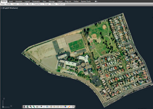
Import terrain images and meshes from anywhere in the world into AutoCAD®
Export your 3D CAD models and drawings to Google Earth™
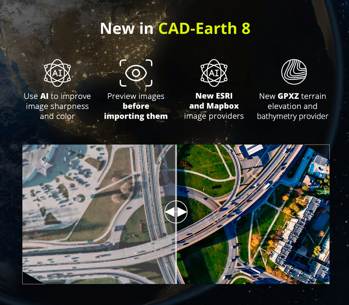
Now with AI to improve image resolution, light, and color.
Images can be imported from major service providers in different resolutions and image modes.
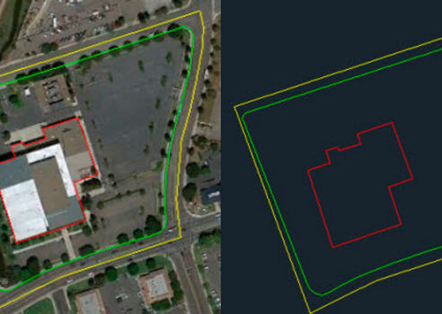
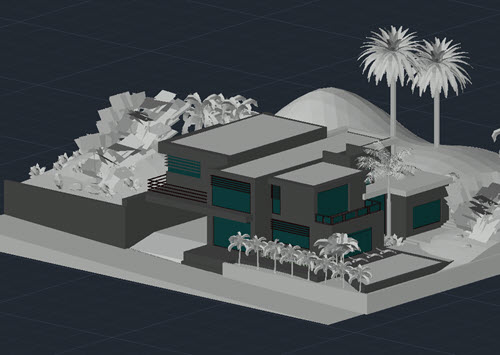
Shows the original CAD objects and the resulting objects exported to Google Earth™.
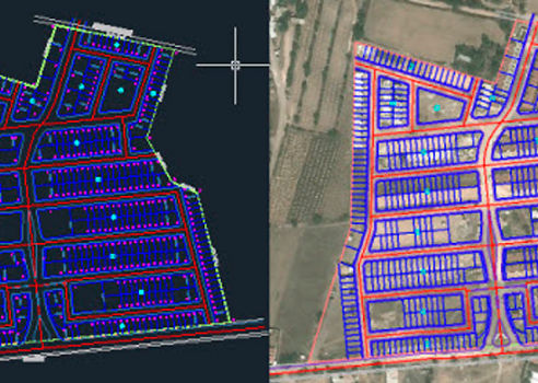
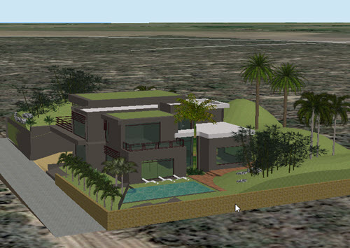
An image showing Google Earth™ polygons and the equivalent objects imported to CAD.
Users can export CAD drawings to Google Earth™ as image overlays.
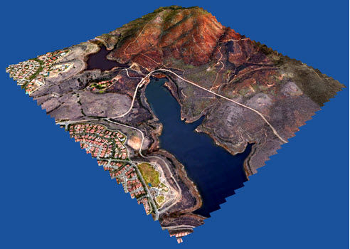
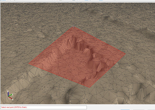
Mesh imported from Google Earth™ to AutoCAD (isometric view).
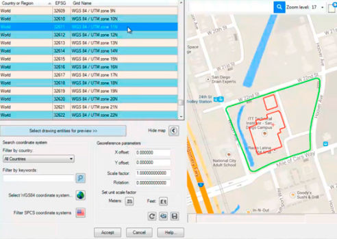
Preview position of selected drawing entities in a map when selecting a coordinate system to georeference a drawing.
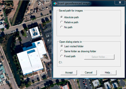
Accurately place an image world file with spatial data in your drawing, applying XY scale and translation transformations.
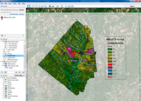
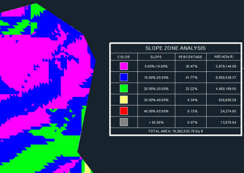
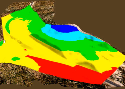
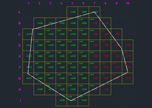
Slope zone legend showing slope range percentages and areas by color.
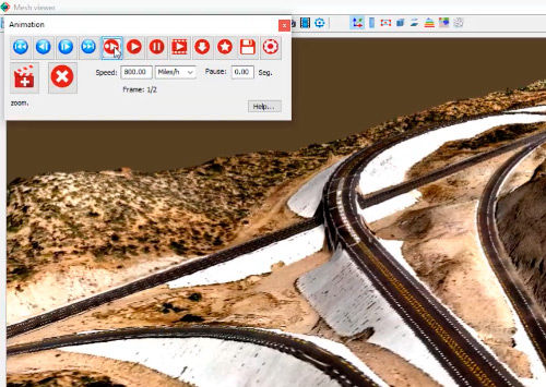
Awesome video animations can be created defining camera position and view direction, speed and pause time.
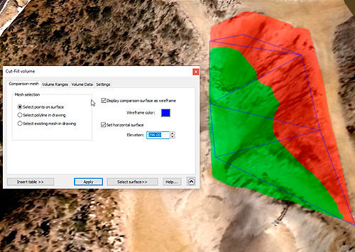
By selecting polygon points on the surface, an existing polyline or mesh in the drawing.
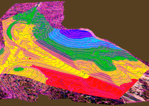
The mesh can also be displayed with colors according to defined elevation and slope ranges.
Contour lines can be instantly displayed defining contour colors and the gap between them.
Export 3D models from AutoCAD™, Civil 3D™ and BricsCAD™ to Google Earth™.
Import 3D models from DAE, 3DS, FBX, and OBJ files to AutoCAD™, Civil 3D™ and BricsCAD.
Terrain mesh editing, importing, creation and visualization commands.
Get cut/fill volume calculations by the grid method and volume reports in Excel format.
Visit our Youtube channel for videos about our software's features.
See a side by side comparison of all CAD-Earth versions.
You can pick CAD-Earth commands from a toolbar, from the screen menu or at the command prompt. Automatic command loading in each CAD session and extensive help in each step.
You can define precise conversion parameters between your drawing and latitude/longitude coordinates by locating the site in a map, by selecting two points in the drawing or by choosing from more than 3000 coordinate systems worldwide.
When you modify object settings the corresponding contour lines, profiles or sections are dynamically updated.
We offer perpetual licenses and annual subscriptions, with free technical support and updates.
It can be used with Google Earth free and Pro versions and in major CAD platforms (AutoCAD® and BricsCAD®). On Windows® 7, 8 & 10 64 bits.
Online Help, Tutorials and Videos
Support via e-mail
Support via remote control
New features requests
See a side by side comparison between CAD-Earth and our competitors.
| FEATURE | CAD-EARTH | OTHER APPS |
|---|---|---|
| Import curvature corrected high resolution tiled images | ||
| Import objects from Google Earth™ or from KML/KMZ files. | ||
| Export drawing entities to Google Earth™ KML/KMZ files
| ||
| Export a drawing as an image overlay to Google Earth™
| ||
| Import terrain mesh inside a closed polyline.
| ||
| Import terrain mesh along a path.
| ||
| Commands to edit terrain meshes. | ||
| Export 3D models to Google Earth™ | ||
| Import 3D models from file | ||
| Import terrain mesh from text file
| ||
| Import terrain mesh from LiDAR and DEM files.
| ||
| Import terrain mesh from LandXML file.
| ||
| Create terrain mesh from points.
| ||
| Create mesh from polylines
| ||
| Create mesh from 3D faces.
| ||
| Export terrain mesh to LandXML file
| ||
| Terrain mesh visualization styles.
| ||
| Historical imagery.
| ||
| Mesh 3D Viewer | ||
| Mesh Explorer | ||
| Insert georeferenced image | ||
| Get cross sections and profiles from terrain mesh | ||
| Georeferencing. | ||
| Insert images, objects and terrain meshes without georeferencing the drawing. | ||
| Technical Support | ||

SUBSCRIBE
Get monthly updates and free resources.