
Import terrain images and meshes from anywhere in the world into AutoCAD®, Civil 3D® and other CAD platforms. Export your 3D models to Google Earth™ and SketchUp. Now with enhanced AI for superior image quality.
The most powerful version yet — with new integrations, smarter algorithms, and AI-driven enhancements.

Seamlessly transfer your 3D CAD models from AutoCAD, Civil 3D and other CAD platforms directly to SketchUp for visualization and presentation.
New specialized commands to insert, delete, move, adjust elevation and edit terrain mesh vertices with greater precision and control.
Significantly faster processing with optimized algorithms for terrain analysis, volume calculations, and contour generation.
Improved AI neural network for superior image sharpness, color balance and resolution enhancement — up to 4x upscaling with natural results.
Instantly preview satellite images before importing them to ensure correct positioning and select the best provider for your project.
CAD-Earth offers an intuitive interface compatible with AutoCAD®, Civil 3D® and other CAD platforms. Explore the full range of features.
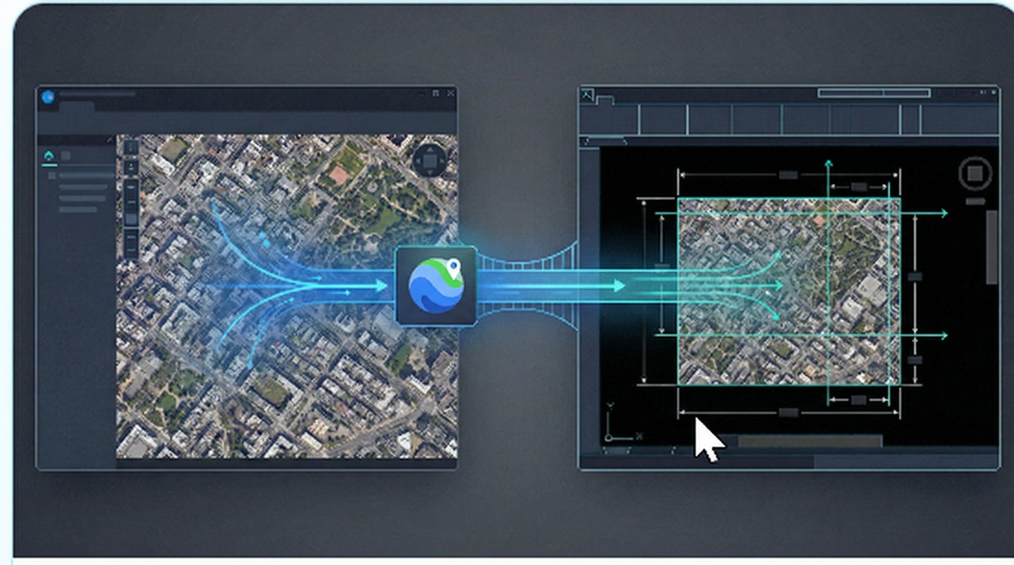
Import high-resolution images from Google, ESRI, Mapbox and other providers in satellite, map or hybrid mode directly into your CAD drawing.
Learn More →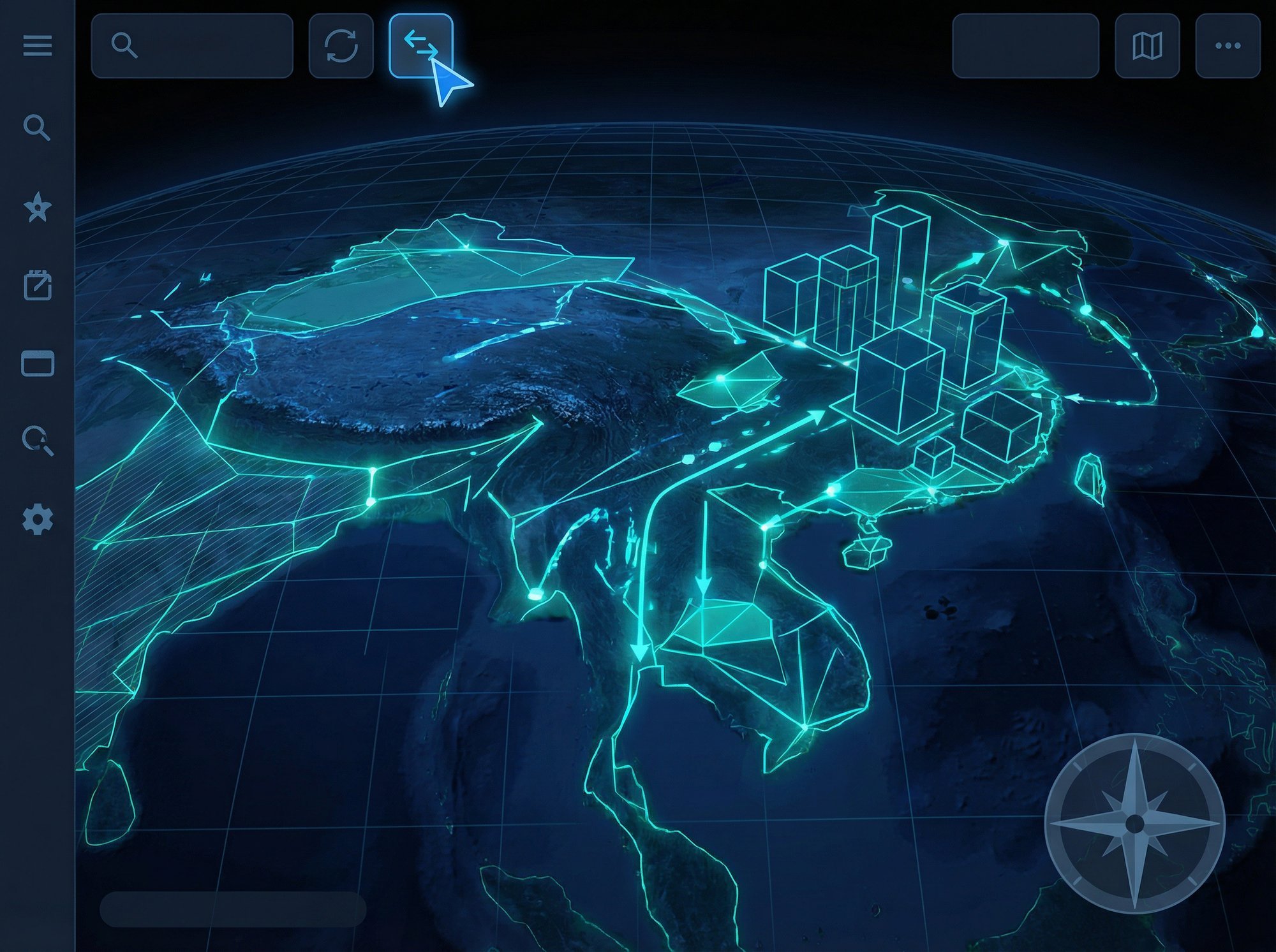
Export lines, polylines, arcs, circles, 3D solids and meshes to Google Earth as polygons, routes or placemarks with full control over appearance.
Learn More →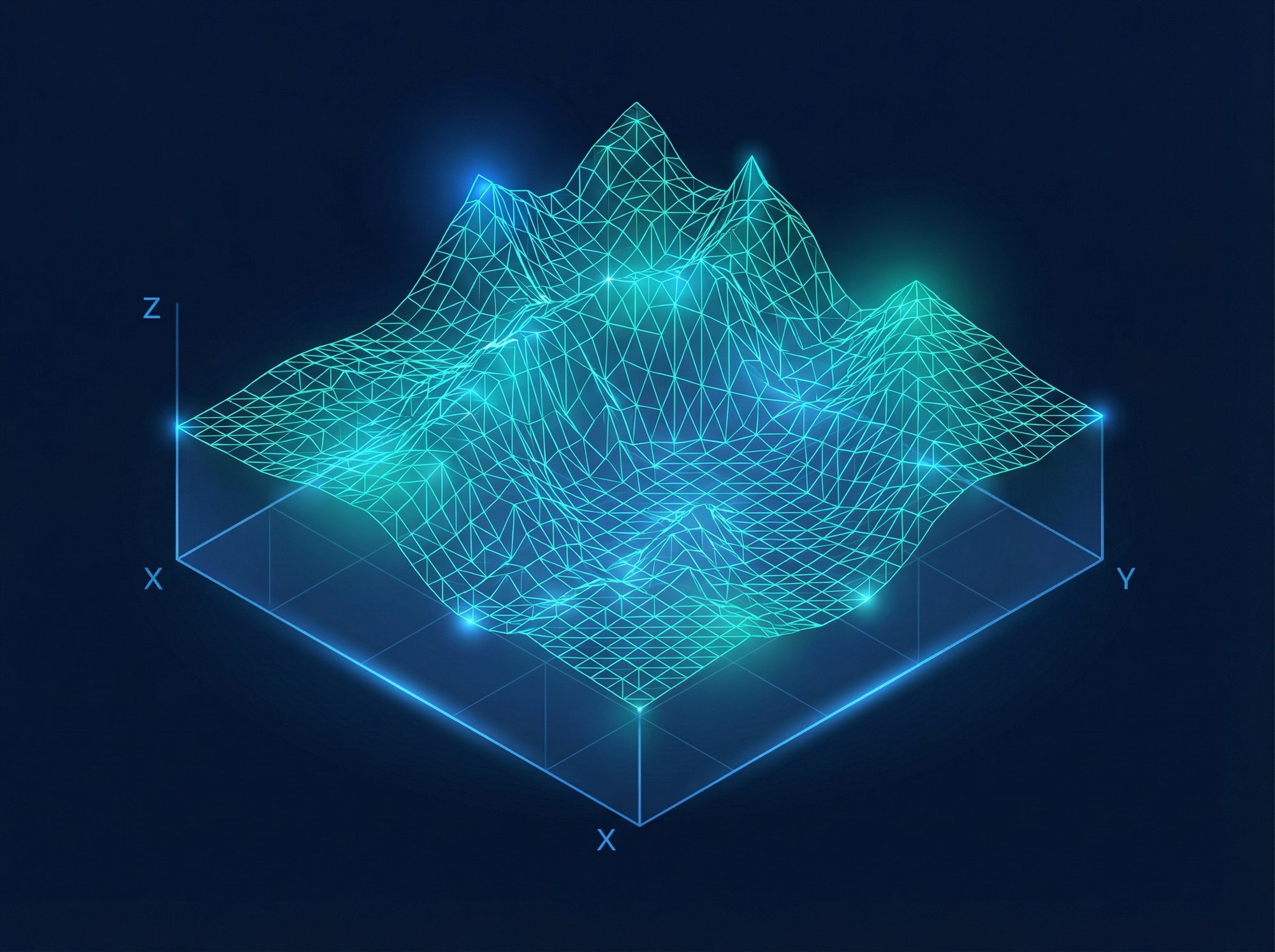
Import terrain meshes from Google Earth, LiDAR, DEM, LandXML and text files. Edit vertices, triangles and break lines with specialized commands.
Learn More →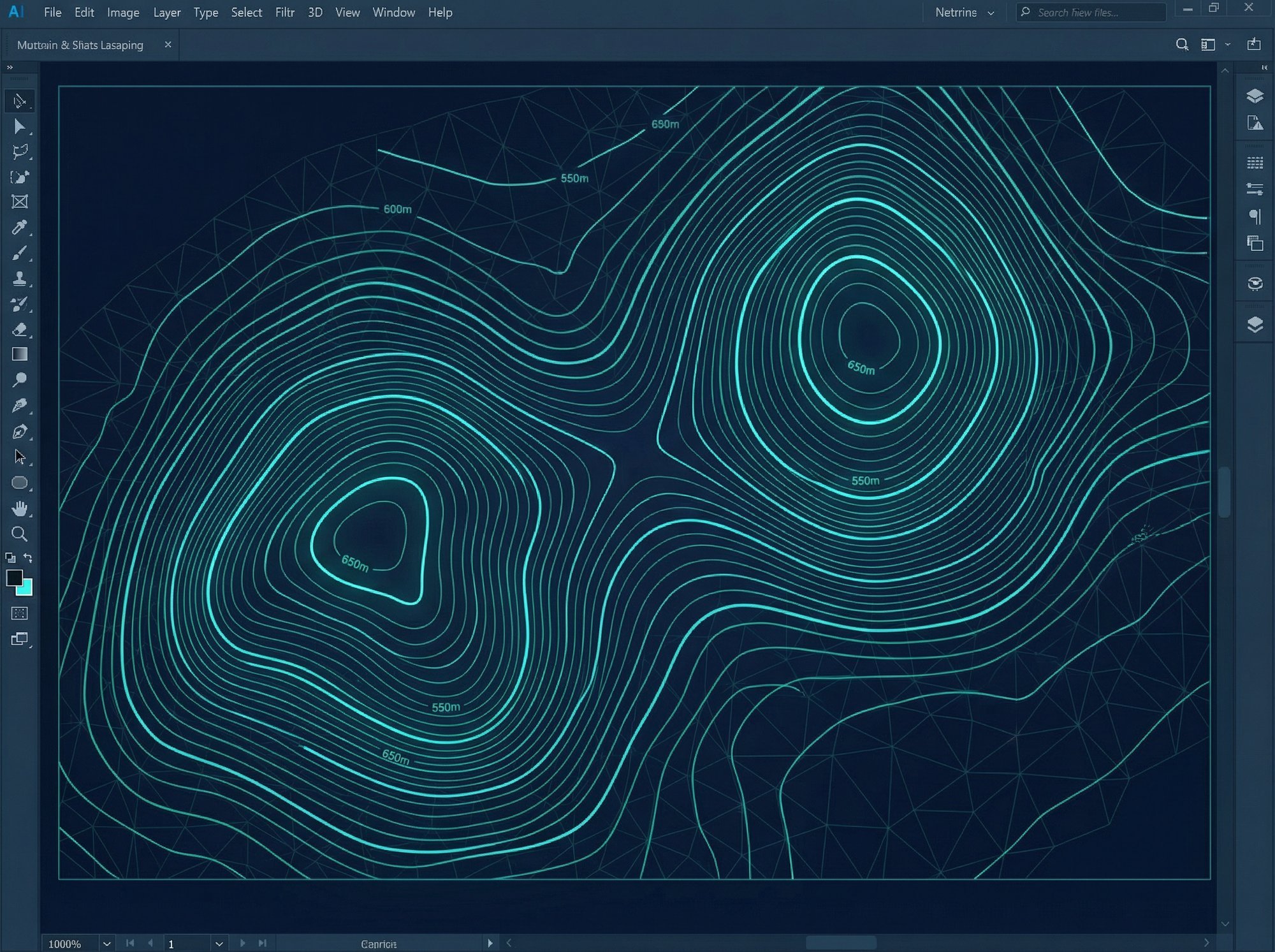
Generate contour lines instantly from terrain meshes with customizable colors, intervals, labels and smoothness. Lines update dynamically when settings change.
Learn More →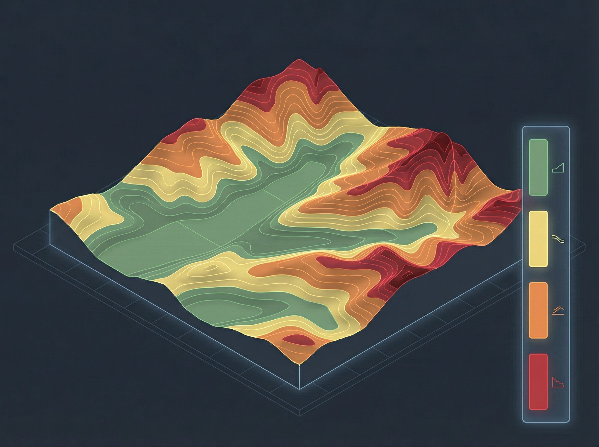
Visualize terrain slope zones in distinct color ranges. Display slope percentages, areas by zone and generate comprehensive analysis reports.
Learn More →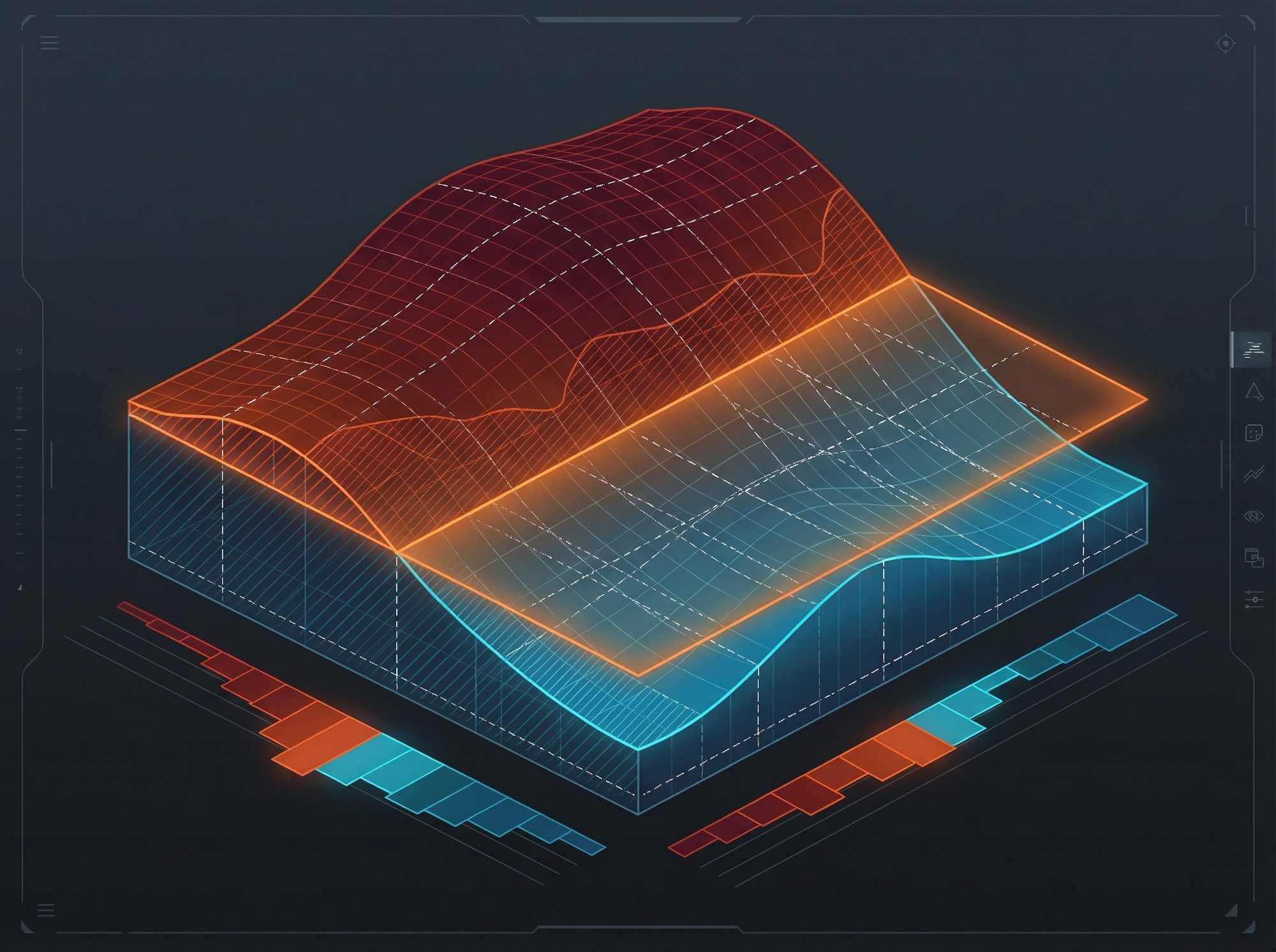
Perform earthwork volume calculations by the grid method. Get detailed Excel reports with cut/fill areas, volumes, shrinkage and topsoil depth.
Learn More →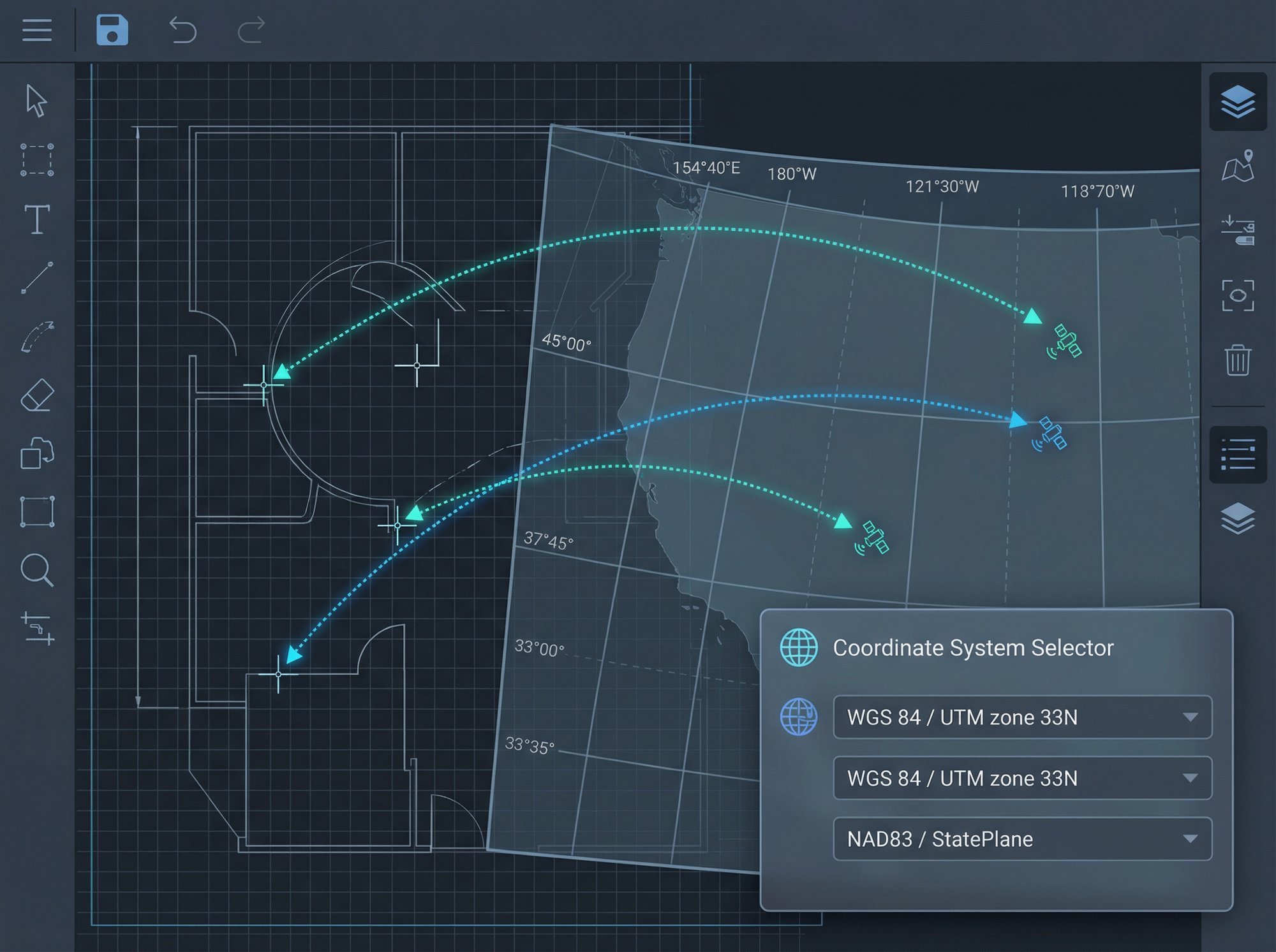
Georeference your drawing using more than 3,000 coordinate systems worldwide. Preview entity positions on a map and align them precisely.
Learn More →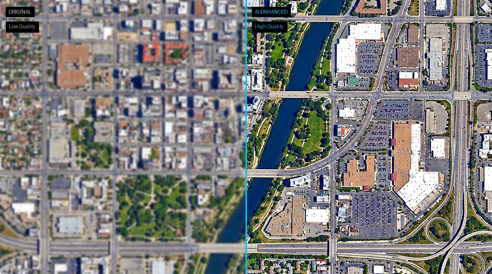
Use AI to improve image sharpness and color. Enlarge images up to 4x using a neural network that enhances resolution, light and color balance.
Learn More →
CAD-Earth is the most complete and affordable solution for integrating CAD with geospatial data. Here is why professionals choose us:
Commands available from toolbar, screen menu or command prompt. Automatic loading in every CAD session.
Precise coordinate conversion between your drawing and geographic coordinates using 3,000+ coordinate systems.
Perpetual licenses and annual subscriptions up to 50% more affordable than competitors. Floating licenses available.
Online help, tutorials, video guides, email support and remote support via TeamViewer at no extra cost.
Works with AutoCAD®, Civil 3D® and other CAD platforms on Windows 7, 8 and 10 (64-bit). Integrates with Google Earth and Cesium.
Choose the plan that best fits your workflow. All plans include free technical support and updates.
Essential tools for image import and basic georeferencing.
Advanced terrain tools and full 3D model integration.
Complete solution with earthwork calculations and SketchUp export.
See a side-by-side comparison of all CAD-Earth versions and features.
See how CAD-Earth stands out with advanced features and superior user experience.
| CAD-Earth vs Competitors | CAD-Earth | Other Apps |
|---|---|---|
| High-Resolution Tiled Images | ✓ | ✗ |
| Import from Google Earth™ / KML | ✓ | ✗ |
| Export to Google Earth™ KML/KMZ | ✓ | ✗ |
| Image Overlay Export | ✓ | ✗ |
| Terrain Mesh Import & Editing | ✓ | ✗ |
| 3D Model Import/Export | ✓ | ✗ |
| LiDAR & DEM File Support | ✓ | ✗ |
| LandXML Support | ✓ | ✗ |
| Mesh 3D Viewer | ✓ | ✗ |
| Cross Sections & Profiles | ✓ | ✗ |
| Georeferencing (3000+ systems) | ✓ | ✗ |
| Historical Imagery | ✓ | ✗ |
| Technical Support | ✓ | ✗ |
| Affordable Pricing (50% lower) | ✓ | ✗ |
Watch tutorials and feature demonstrations on our YouTube channel.